
Land Development
Land Development Surveying in Bendigo
Detailed, precise surveys that form the foundation for successful land development across Bendigo and central Victoria. We give designers and developers accurate ground to build on, from the first contour survey through to subdivision.
Prefer email? Reach us at quotes@5dsurveying.com.au
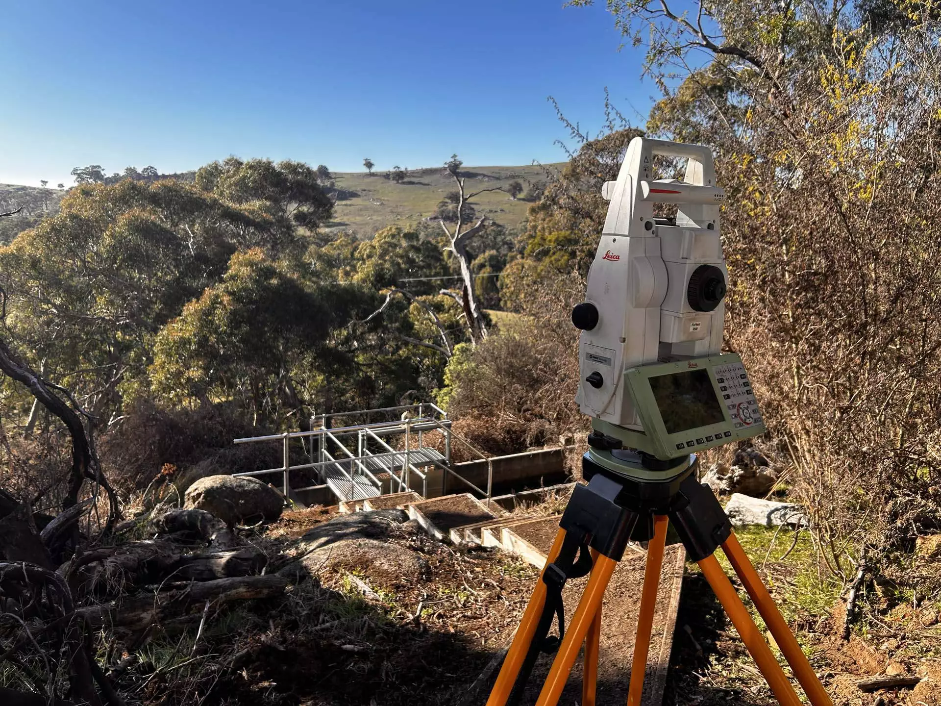
Trusted by builders, developers and councils across central Victoria














What we do
Land Development surveying includes
- Feature (detail) surveys
- Topographic & contour surveys
- Site analysis plans
- Title re-establishment surveys
- Boundary setouts
- AHD finished floor level & TBM certification
- Flood level surveys
- Footing & house setouts
- Subdivisions
- Underground service mapping
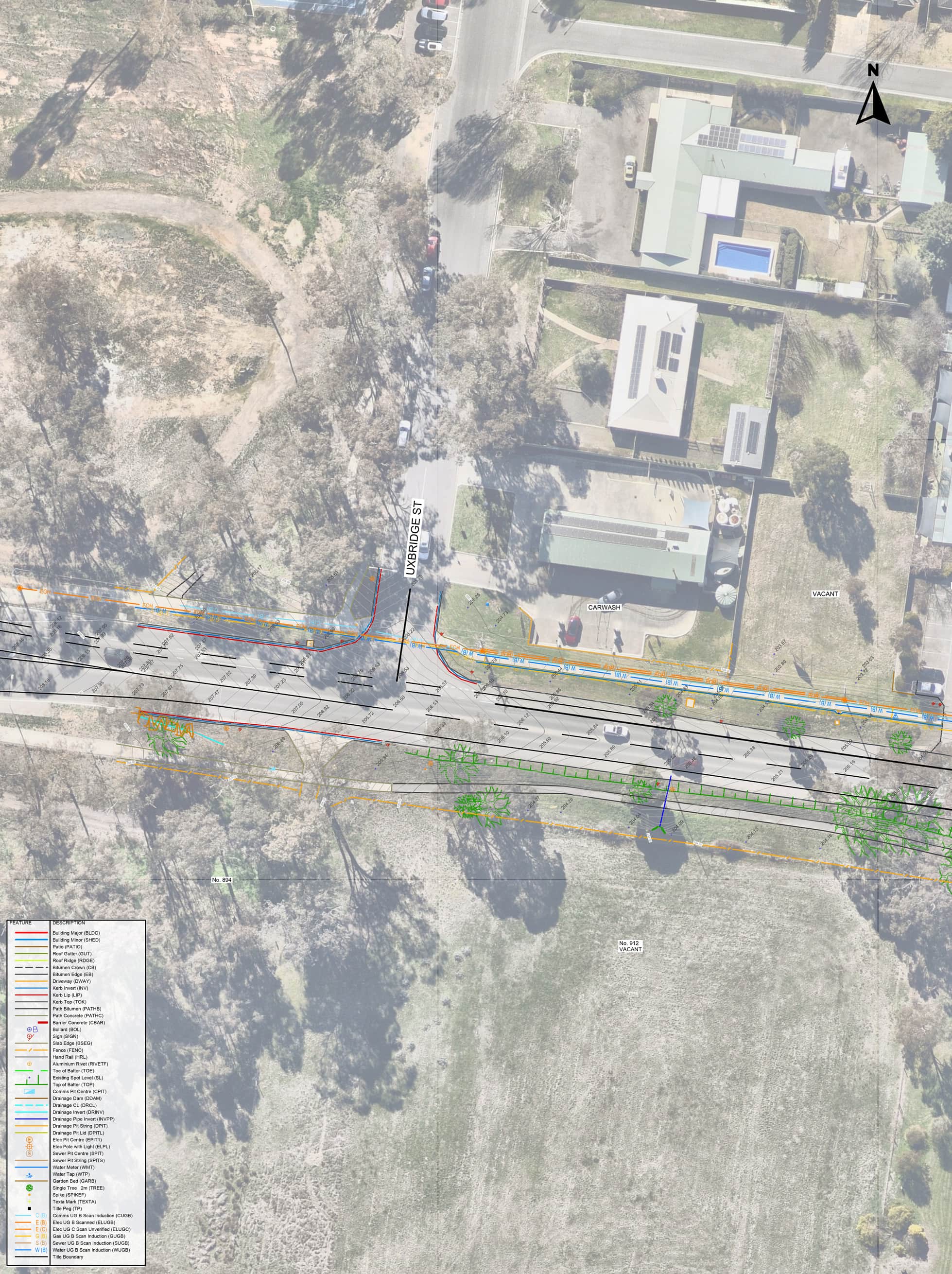
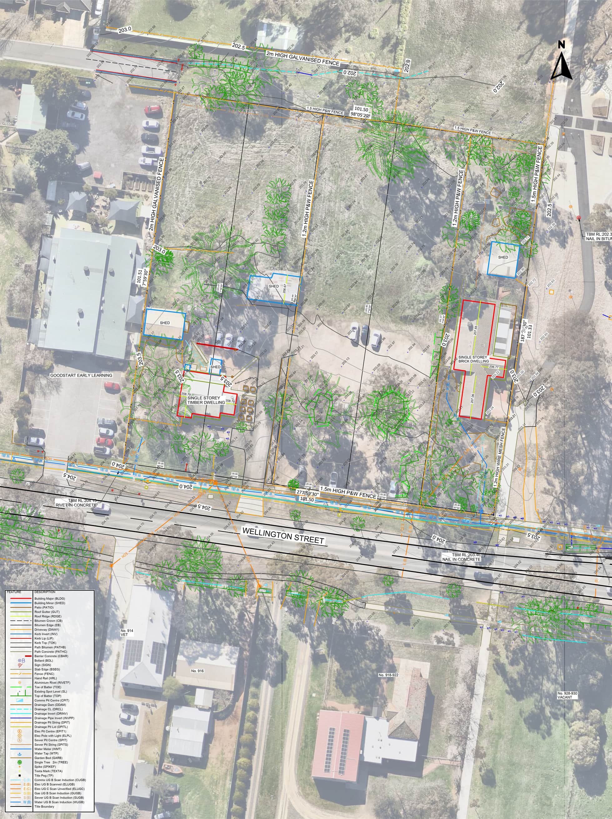
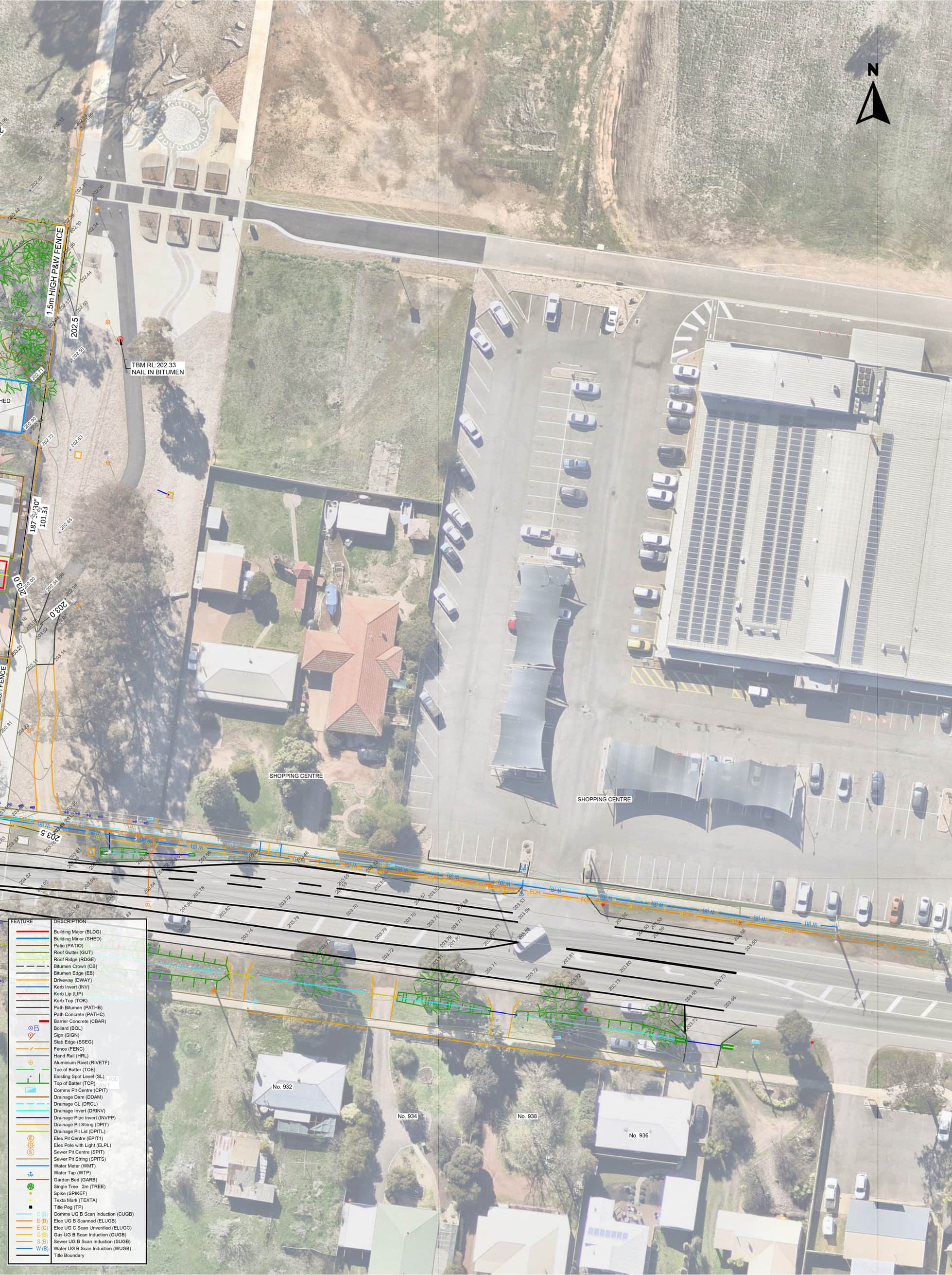
Comprehensive feature and level surveys
Feature and level surveys, also known as contour surveys, are the starting point of any development. We document every site feature, existing buildings, tree locations, and the heights and positions of neighbouring structures, along with street detail and assets like drainage, communication pits and electrical services. Once the data is captured, our team produces detailed AutoCAD (DWG) and PDF plans for you or your design team.
Detailing every unique aspect of your site.
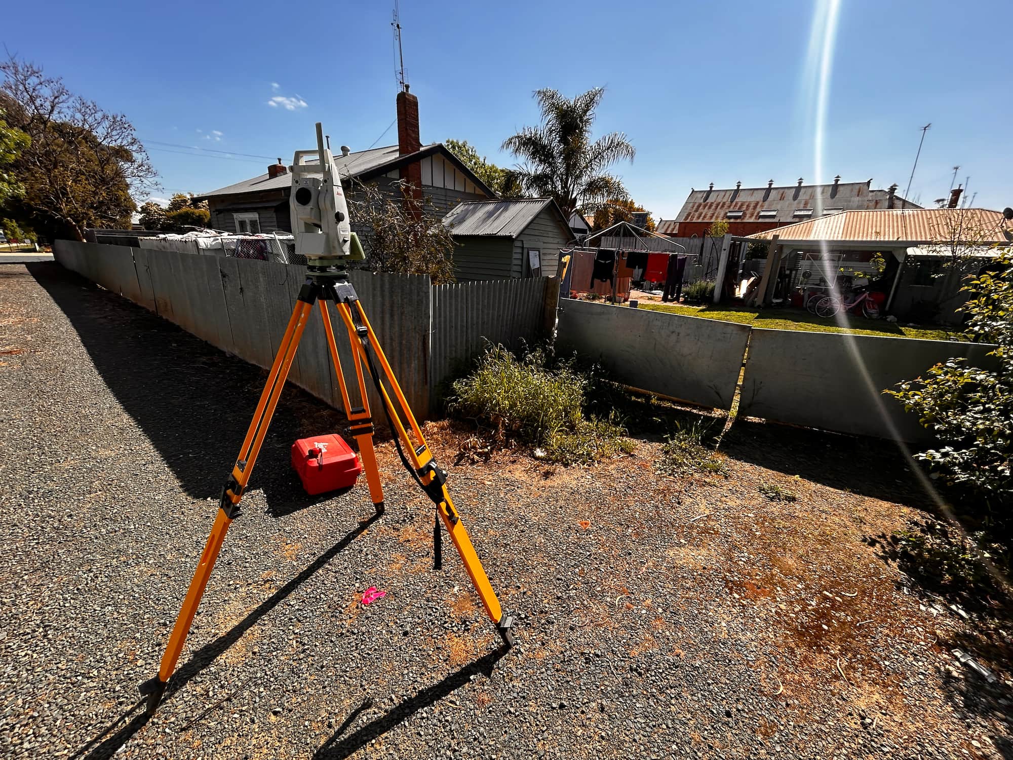
Cutting-edge technology for high accuracy
We pair advanced surveying equipment with proven techniques to deliver data that is both highly accurate and cost-effective. Whether you need detailed contours, precise boundary lines or comprehensive site levels, our technology-driven approach reduces the risk of costly errors and keeps your development moving.
Precision and affordability, delivered.
What you receive
- AutoCAD Plan and Surface file (DWG)
- PDF Plans and associated aerial imagery
- Certificate of Survey or Letter if required
- Contours at 0.2m intervals or custom
Areas we service
From Bendigo to Echuca, Shepparton and everywhere in between
Why 5D Surveying
The detail that keeps
projects on track
Expertise and experience
RMIT-qualified surveyors with backgrounds across mining, rail, civil and subdivision projects nationwide. Decades of field experience behind every job.
Advanced technology
Drone photogrammetry, GPS machine control for Trimble, Topcon and Leica, and terrestrial laser scanning, delivering precise, reliable results.
Customer-centric delivery
A site visit guaranteed within 10 days, a quote within 2, and a detailed plan after every single visit. Communication you can plan around.
Reviews
What clients say about working with us
 5.0 from 11 Google reviews
“The 5D Surveying team were very professional and easy to deal with. They completed our surveying brief well within time, delivered on expectations and were very responsive to any questions. I will certainly be using 5D on our next job.”
“We've used 5D for an array of services and no one else compares in terms of quality, proactivity and professionalism. From set outs to drafting As-Builts, they can do it all.”
“5D Surveying impressed us with their clear communication and quick turnaround. Their accurate data made our design process much smoother. We highly recommend them for reliable, efficient surveying.”
“Their 3D machine control models and lidar accuracy revolutionised our workflow. Minimal rework, no downtime waiting on deliverables. A key strategic partner who understands large-scale construction.”
FAQs
Land Development surveying questions
A feature and level (or contour) survey records the existing detail of your site, levels, contours, buildings, trees, fences, boundaries and services, so your designer or engineer has an accurate base plan to work from.
Yes. Subdivisions require accurate boundary and feature information to lodge plans and meet council and Land Use Victoria requirements. We can handle the survey work from the initial feature survey through to subdivision setout.
You'll receive detailed AutoCAD (DWG) and PDF plans showing levels to AHD or an arbitrary datum, contours at 0.2m intervals, and all relevant fences, easements, boundaries and building envelopes.
We guarantee a site visit within 10 days and reply to quotes and queries within two days. For urgent jobs, give us a call and we'll do our best to fit you in sooner.
We're based in East Bendigo and work right across central and regional Victoria, including Echuca, Shepparton, Castlemaine, Kyneton and surrounds.
Land Development
Ready to get started?
Tell us about your project and we'll come back with a quote within two days.